 |
|
|
|
|
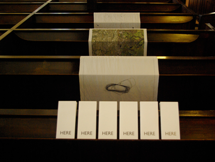
Here (2010)
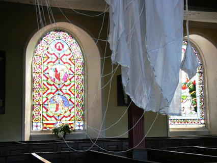
Save Us, curated by Karen Gaskill, for Barnaby Festival, Macclesfield, UK.
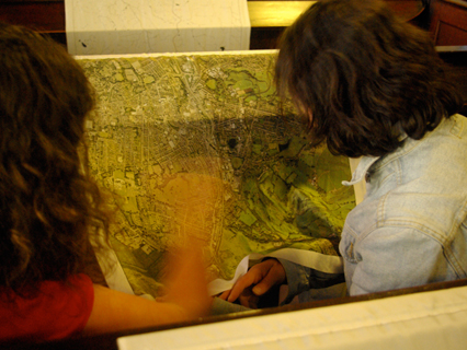
Here is a series of silk maps and a walking tour that bring together the aerial perspective of the pilot in the sky, the close-up view of the map-user on the ground and the omnipresence of Google maps. You are invited to go for a walk to the site of an emergency landing near Macclesfield with the artist’s map, to see the place where a pilot had to navigate from the sky to the safety of the ground.
During the Second World War Macclesfield produced silk for escape maps and parachutes. This safety equipment accompanied pilots across the skies, only being used when the escape route from the here of an emergency to the here of safety needed to be found.
‘Here’ is a new work exploring navigation, maps and flight. It is the here of a memory associated with a specific place. It is the you are here of navigation technologies such as maps, GPS and Sat Nav. It is the here and now of your current location and a literal here of Macclesfield.

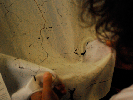
The work HERE began in fieldwork with walkers and a pilot using GPS devices to navigate. The walkers and the pilot while using GPS devices were all positioned very specifically in a landscape and had only partial views. All maps are only partial views, the idea of a ‘gods eye’ view is made through ignoring what is left out in a satellite image or a map. In seeing the view from the air, with light reflecting and refracting off pools of water the specificity of the landscape and the pilots reading of it became clear
. A series of partial and slippery maps were the result of this work. They are part of the work ‘here’ in which mistaken locations and cloud cover had lead to forced landings of aircraft, where views from above were no longer god’s eye views but fallible and situated views. These views are entangled with histories of war, specifically the aerial histories of bombing during WW2 in which silk maps were used by pilots as escape aides. The partial nature of maps and GPS as military technologies, that produce landscapes through their use in reconnaissance and in targeting, are here made obvious as they are printed on silk scarves, that are slippery, warm, and potentially worn next to the body. They speak of the fragility of the body at height, and the partial nature of maps.
The material of silk is important here, not just because it was used to make maps, but that in itself it holds a material story of failed flight. Part of the process of breeding silk moths over 5,000 years has made them flightless. This is of no consequence however because to harvest the silk at its best quality the moth must be killed in boiling water before it emerges from its cocoon. So the dead, flightless silk moth is used as a machine to produce silk which is then woven into fabric that was used to make both parachutes and maps. Parachutes that helped pilots in planes that had been made flightless by war descend safely to the ground, and maps which would help them to escape capture.
The material of silk itself is entangled in flight and the failure of flight, and of the urgency of bodies in specific danger from gravity and from war. The work ‘HERE’ entangles flight, mapping, reconnaissance and the failure of flight in partial perspectives.